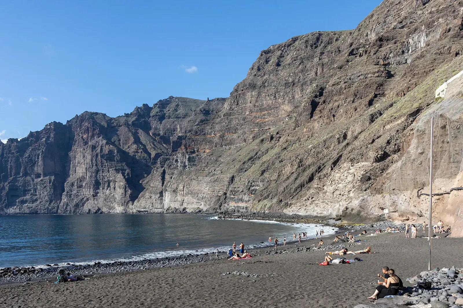
Photo by Photograph by Mike Peel ( www.mikepeel.net )., CC BY-SA 4.0, via Wikimedia Commons
Los Guíos beach, Tenerife: below the Los Gigantes cliffs
Los Guíos is the beach of Los Gigantes, in Santiago del Teide: a strip of about 180 metres of black sand and rocks next to the marina, wedged at the foot of the Los Gigantes cliffs, which according to Canary Islands Tourism reach up to 600 metres high. The water is usually calm, the beach has lifeguards in season and there are sunbeds, toilets and showers, but it is small, urban and gets crowded. Its reason for being is the scenery: swimming with the vertical wall above you. Before you go, bear in mind that the slope around it, held in place with netting, has led to partial closures because of rockfall risk, so check its status on the day.
At a glance
- Area and municipality: Los Gigantes, west coast, municipality of Santiago del Teide, next to the marina.
- Sand: natural, black or dark, with rocks.
- Approximate length: about 180 metres, and about 20 metres wide.
- Waves and wind: generally calm water, although currents can be strong when there is a swell.
- Lifeguards: supervised beach in season.
- Facilities: sunbed, parasol and water sports equipment hire, toilets, showers, foot showers, bars and restaurants; one restaurant opens onto the sand.
- Blue Flag 2026: no.
- Accessibility: there is an access ramp, but the Tenerife Tourism listing does not class the beach as accessible for people with disabilities.
- Parking: no parking of its own; the nearest is the paid car park at the marina, and the streets of Los Gigantes are narrow and steep.
- TITSA bus: guagua (the local word for bus) lines 473 (Los Cristianos–Los Gigantes) and 477 (Costa Adeje–Los Gigantes, direct); about fifteen minutes on foot from the stop.
- Best for: seeing the cliffs from below, combining the beach with a boat trip, paddleboarding, diving and sunsets.
- Drawbacks: small and very busy, possible partial closures because of the slope and difficult parking.
The cliffs and the slope
The Los Gigantes cliffs close off the Teno massif to the south and drop vertically into the sea; Los Guíos is the only spot in the area where you can sit on the sand right beneath them. That same landscape is also its risk: the slope around the beach is protected with netting and the town council has fenced off sections in the past because of the risk of falling rocks. Always respect fences and signs, do not lie right up against the rock face even if there is shade there and, if you find the beach fully or partly closed, do not go in. Playa de la Arena, in Puerto de Santiago, is the alternative a kilometre and a half away.
How to get there
By car, from the south follow the TF-1 towards Guía de Isora and continue on the TF-47 via Playa San Juan, Alcalá and Puerto de Santiago to Los Gigantes; from the north, the road comes down through Santiago del Teide. The town is a hillside development of narrow streets, so the practical option is to leave the car in the paid car park at the marina, next to the beach, which fills up in high season.
By bus, TITSA line 473 links Los Cristianos with Los Gigantes via Costa Adeje, Adeje, Playa San Juan and Puerto de Santiago in around an hour and twenty minutes; line 477 runs direct from Costa Adeje bus station in about 50 minutes. From the stop it is about a fifteen-minute walk down to the beach. Check timetables and diversions on the TITSA website and look at the guide on how to get around Tenerife.
The sea and safety
The beach is sheltered by the marina and the water is usually calm, but currents can be strong when there is a swell. Swim within the supervised area and respect the flag. The seabed is rocky: water shoes make getting in easier. Do not swim towards the marina entrance, where boats come and go.
What is nearby
Boats leave Los Gigantes marina to run along the base of the cliffs, as do the whale and dolphin watching trips closest to Teno, with the Masca inlet as a backdrop. The Archipenque viewpoint, on the road into town, gives the classic photo of the cliff wall. A kilometre and a half away, Playa de la Arena is wider and has adapted access. Up the road, the TF-436 leads to Masca along a narrow route of hairpin bends; the guide to what to see in south Tenerife suggests how to combine everything in a day, and the guide to viewpoints in Tenerife covers more views in the area.
Best time of day and year
In the morning there is more room on the sand and in the car park. At sunset the sun goes down over the sea opposite La Gomera, with golden light on the cliffs.
West Tenerife has sun and mild temperatures all year. In winter there are more days of ocean swell, which can make swimming harder and cancel the odd boat trip. The guide to the best time to visit Tenerife compares the seasons.
Frequently asked questions
Is Los Guíos beach open?
Normally yes, but the slope around it has led to partial closures because of rockfall risk. Check its status on the day through Santiago del Teide town council notices and respect the fences.
Is it safe to swim?
The water is generally calm and the beach has lifeguards in season. When there is a swell the currents can be strong: respect the flag and swim in the supervised area.
Where can you park for Los Guíos?
In the paid car park at Los Gigantes marina, next to the beach. The beach has no parking of its own and the streets of the town are narrow and steep.
Los Guíos or Playa de la Arena?
Los Guíos gives you the cliff overhead and the marina next door, but it is smaller and narrower; Playa de la Arena, a kilometre and a half away, is wider, has adapted access and better parking. For families, the second; for the scenery, the first.
Does it have a Blue Flag?
It is not on the official 2026 list. On the west coast, La Jaquita in Alcalá and Playa San Juan hold one in 2026.
Keep planning
- The best beaches in south Tenerife: the beaches of the west compared.
- Whale and dolphin watching in Tenerife: trips from Los Gigantes.
- The best beaches in Tenerife: the island-wide selection.
- Where to stay in Tenerife: Los Gigantes as a base.
You may also like
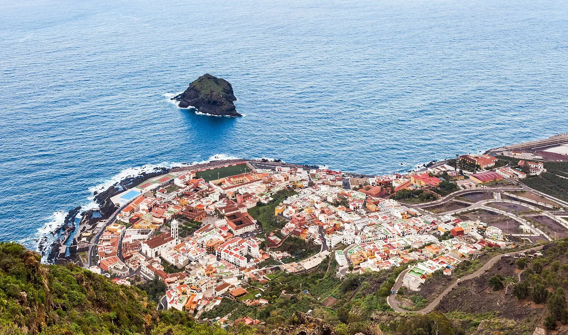
Garachico, Tenerife: old town, El Caletón and the Isla Baja
What to see in Garachico in half a day: the port buried by lava in 1706, the historic centre, El Caletón, the castle, San Roque, buses and where to park.
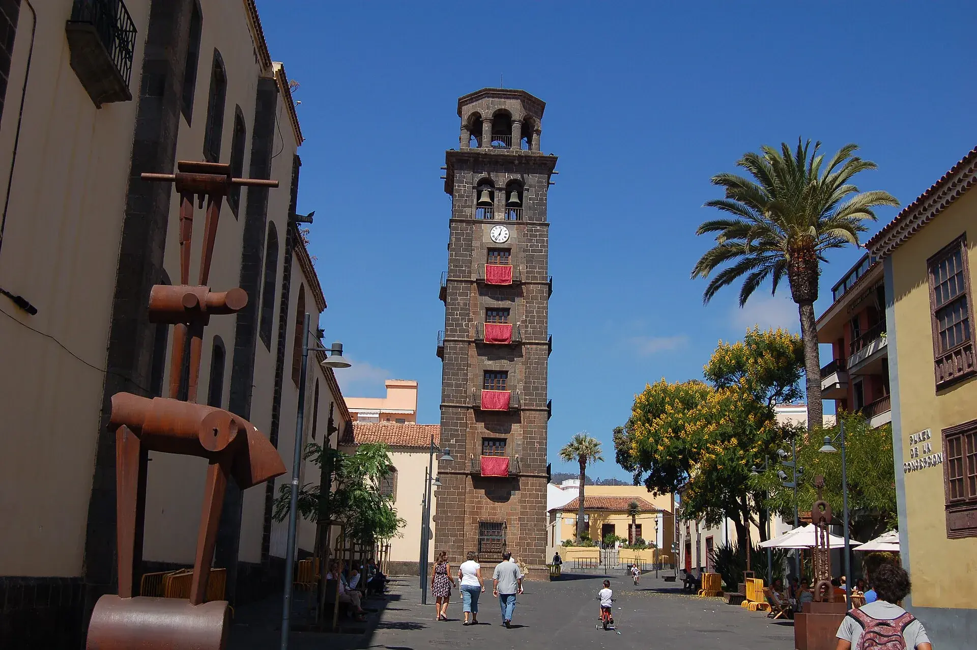
La Laguna, Tenerife: old town, museums and how to get there
What to see in La Laguna step by step: walking route through the World Heritage old town, cathedral, museums, tram, parking, festivals and a trip to Anaga.
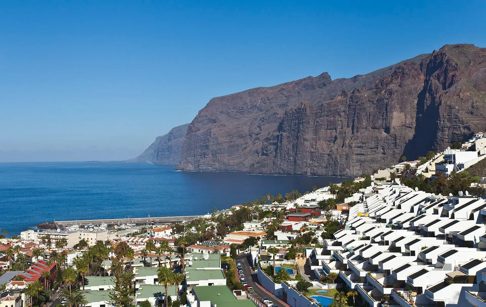
Los Gigantes Tenerife: cliffs, boat trips, beaches and access
Los Gigantes (Tenerife): cliffs up to 600 m, Archipenque viewpoint, boats from the marina, Los Guíos, rock pools, buses 473 and 477 and where to park.
Tenerife protected areas rules: trail quotas and drones
Rules for Tenerife's protected areas: trails that need booking, Teide, Masca and El Pijaral, drones, camping, wildfire alerts, dogs and fines in 2026.