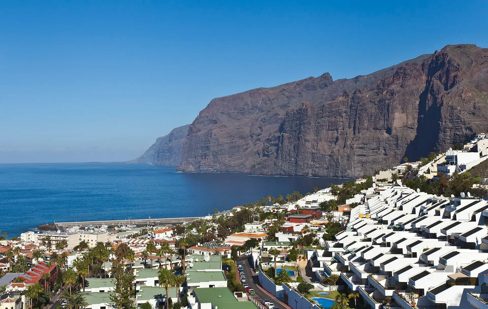
Photo by Diego Delso, CC BY-SA 3.0, via Wikimedia Commons
Los Gigantes Tenerife: cliffs, boat trips, beaches and access
Los Gigantes, on the west coast of Tenerife (municipality of Santiago del Teide), is the village at the foot of the cliffs of the same name: walls of volcanic rock that, according to the Canary Islands tourist board, reach 600 metres in height and drop vertically into the sea. You can see the essentials in half a day: the classic view from the Archipenque viewpoint, Los Guíos beach beneath the wall, a boat from the marina to grasp the real scale, and the sunset facing La Gomera. Together with Puerto Santiago and Playa de la Arena it forms a quiet resort area, with a direct bus (guagua, as buses are called in the Canaries) from Costa Adeje, that works as a day trip from the south or as a base for exploring Teno and Masca.
The cliffs: what they are and where to see them best
The Los Gigantes cliffs are the southern face of the Teno massif, the oldest part of the island, which was an independent island before later eruptions joined it to the rest of Tenerife. The sea has cut into that block until it left a continuous wall several kilometres long, broken by ravines that open onto small coves reachable only by sea, such as the one at Masca. According to the tradition recorded by the Canary Islands tourist board, the Guanches called it the wall of hell.
There are three ways to see them, and each shows you something different:
- From above, at the Archipenque viewpoint: the entire wall, the marina and La Gomera in the background. This is the classic photo.
- From below, on Los Guíos beach: the sense of height, with the rock towering over you.
- From the sea, by boat or kayak: the only way to appreciate the scale and see the coves and the mouth of the Masca gorge.
If you go to Punta de Teno you will also see them in profile, from the western tip of the island; this is explained in the guide to Teno Rural Park.
Archipenque viewpoint
It is on the TF-454, at the entrance to Puerto Santiago coming from Tamaimo, at kilometre 6. From the railing you see the cliffs along their whole length, the marina and, on clear days, La Gomera and the Punta de Teno lighthouse. It has a small car park and step-free access.
Best time: sunset, with the sun going down beside La Gomera. Arrive half an hour early, because the car park fills up.
A walk around the village and the marina
Los Gigantes is a hillside development of narrow streets running down to the marina. There is no historic centre to explore: the interest lies in the promenade by the marina, the beach and the wall that encloses it all. A practical order:
- Marina: the departure point for boats and kayaks, with terraces and the best sea-level view of the cliffs.
- Los Guíos beach: right next to the marina, at the foot of the wall.
- Coastal rock pools: on the other side of the marina, among the rocks.
- Walk towards Puerto Santiago: along the upper part, in the direction of Playa de la Arena.
Time: two hours without a boat; half a day with a boat and a swim.
Los Guíos beach
This is the beach of Los Gigantes: a small strip of black sand and rocks next to the marina, tucked in beneath the cliff. The water is usually calm and it has facilities and lifeguards in season, but it is an urban beach and fills up early. Its weak point is the same as its appeal: the slope is protected with netting because of falling rocks, and sections have been cordoned off in the past. Respect fences and signs and do not lie right up against the wall. Access, facilities and closures, in detail, in the guide to Los Guíos beach.
Rock pools and natural swimming pool
The rocky coast between Los Gigantes and the Isla Cangrejo development has charcos (natural pools formed in the lava) where locals swim when the sea is calm. The best equipped is the one at Isla Cangrejo, protected by a concrete wall and with steps into the water, but with no lifeguards or facilities. It is only safe at low tide with a calm sea: at high tide and with swell the sea washes over the wall. Wear water shoes. Conditions at this and other pools on the island are in the natural pools of Tenerife.
By boat from the marina
Excursion boats leave Los Gigantes marina every day, running along the base of the cliffs to the Masca inlet, often with a stop for a swim, along with whale and dolphin watching trips. This coast is part of the Teno-Rasca marine strip, a Special Area of Conservation with a resident population of short-finned pilot whales and bottlenose dolphins, so it is common to see them on the way.
- Usual duration: two to three hours.
- Who it suits: everyone, including young children who cannot walk down the Masca gorge.
- What to look for when choosing: that the boat has the Canary Islands Government's Barco Azul (Blue Boat) badge for responsible whale watching, the group size and whether a swim stop is included.
- Active alternative: guided sea kayak tours beneath the wall, with caves; you need to be able to swim.
Ports, seasons and whale-watching rules compared in whale and dolphin watching in Tenerife.
Arriving by boat from Masca
Los Gigantes is also the finish line for anyone hiking down the Masca gorge: the route is downhill only and ends at the inlet, from where a boat takes hikers to Los Gigantes marina. The boat ticket is bought separately and must match your descent slot. If you are doing the hike, plan in advance how you will get back from Los Gigantes to your accommodation or to Santiago del Teide, where you left the car: by bus or taxi. Booking, bus 355 and rules are in the Masca gorge.
Puerto Santiago and Playa de la Arena
Puerto Santiago, adjoining Los Gigantes to the south, is the old fishing village that grew with tourism. Its big asset is Playa de la Arena, the best-equipped black-sand beach in the west, with facilities, step-free access and the cliffs as a backdrop, a kilometre and a half from the marina. It is a better option than Los Guíos for spending the day with children or without the crowds. Further south, along the TF-47, Alcalá and Playa San Juan (Guía de Isora) add rock pools, a promenade and a local atmosphere.
How to get to Los Gigantes
By car
From the south, take the TF-1 towards Guía de Isora and continue on the TF-47, the coast road, through Playa San Juan, Alcalá and Puerto Santiago: around 40 minutes from Costa Adeje, with one lane in each direction and heavy traffic at rush hour. From the north, drive down the TF-82 to Santiago del Teide and from there through Tamaimo (TF-454), passing Archipenque; the bends between Tamaimo and Los Gigantes have poor visibility.
Where to park
This is the weak point. The streets are narrow, steep and short of space. The practical option is the paid car park at the marina, next to Los Guíos, which fills up in high season and at midday. In Puerto Santiago and by Playa de la Arena there is more on-street space. At sunset, the car park at the Archipenque viewpoint is overwhelmed.
By bus
As of October 2026, according to TITSA (the island's bus company):
- 477 Costa Adeje (bus station)–Los Gigantes, direct: about 50 minutes, via Playa San Juan, Alcalá and Puerto Santiago; departures roughly every hour on weekdays and slightly fewer at weekends.
- 473 Los Cristianos–Los Gigantes: around one hour twenty minutes, via Costa Adeje, Adeje, Armeñime, Playa San Juan and Puerto Santiago.
- 325 Puerto de la Cruz–Icod–Los Gigantes: an hour and three quarters, via El Tanque and Santiago del Teide; the link with the north.
From the last stop you walk down to the marina, with a climb on the way back. Check timetables and roadworks diversions on the TITSA website.
Staying in Los Gigantes: who it suits
Los Gigantes and Puerto Santiago have hotels and apartments and a loyal clientele, mostly couples and long-stay winter visitors from northern Europe.
- Yes, if you want: peace and quiet, sunshine almost all year, sunsets over the sea, boats and kayaks on your doorstep, and proximity to Masca, Teno and the entrance to Teide via Chío.
- No, if you want: nightlife, large sandy beaches or to get around a lot without a car; the hills are also hard going for people with reduced mobility.
- Alternative: Playa San Juan or Alcalá, smaller and more local, ten minutes away.
The comparison with Costa Adeje, Los Cristianos or the north is in where to stay in Tenerife.
When to go
The west is one of the sunniest parts of the island all year round, as it is sheltered from the trade winds (the north-easterly winds that bring clouds to the north). The cliffs look good in any month; what changes is the sea. With a groundswell, more common in winter, some boats cancel and the rock pools close. In summer, the heat is intense at midday: save the beach for the morning and the viewpoint for the afternoon.
Common mistakes
- Driving down to the marina at midday in high season. The car park will be full; go first thing or take the bus.
- Lying at the foot of the wall. Rockfall is real; respect the fences.
- Swimming in rock pools without a wall when there is swell. If the sea is breaking on the rocks, there is no swimming.
- Choosing a boat on price alone. Look for the responsible whale-watching badge and the group size.
Frequently asked questions
How high are the Los Gigantes cliffs?
According to the Canary Islands tourist board they reach 600 metres at their highest point. They drop vertically into the sea for several kilometres, between Los Gigantes marina and the mouth of the Masca gorge.
What is the best way to see the cliffs?
Combine the Archipenque viewpoint at sunset with a boat trip from the marina. The viewpoint gives you the full view; the boat, the real scale and the coves that can only be reached by sea.
How do you get to Los Gigantes without a car?
On TITSA line 477, direct from Costa Adeje bus station in about 50 minutes, or on the 473 from Los Cristianos. From Puerto de la Cruz, the 325 arrives via Icod and Santiago del Teide.
Can you swim in Los Gigantes?
Yes: at Los Guíos beach, next to the marina, with lifeguards in season, and in the coastal rock pools when the sea is calm. For a full beach day, Playa de la Arena, in Puerto Santiago, has more space and facilities.
Can you see Masca from Los Gigantes?
Not from the village: the Masca inlet lies behind the wall. You see it on the boat trips along the cliffs, and that is where the gorge descent ends.
Keep planning
You may also like
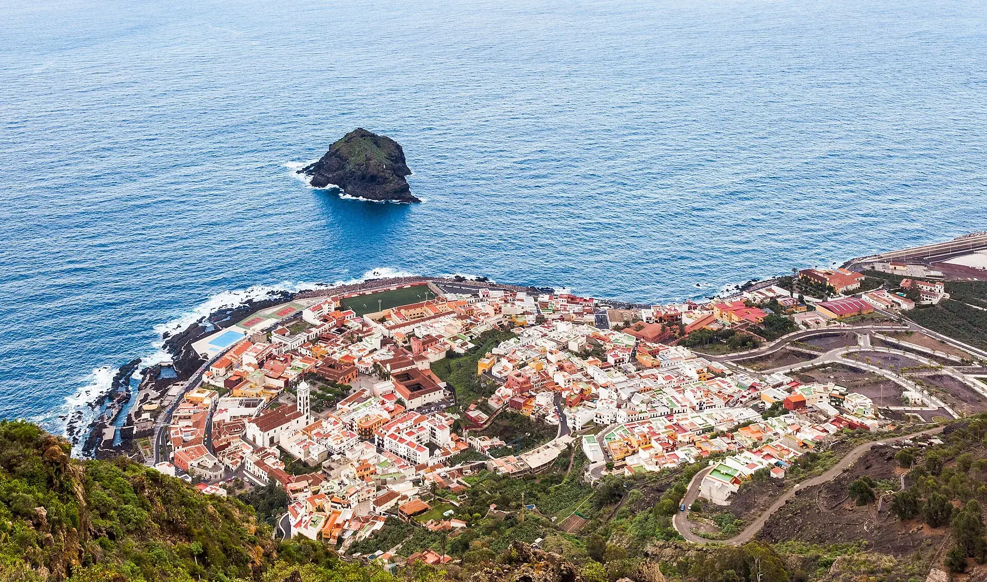
Garachico, Tenerife: old town, El Caletón and the Isla Baja
What to see in Garachico in half a day: the port buried by lava in 1706, the historic centre, El Caletón, the castle, San Roque, buses and where to park.
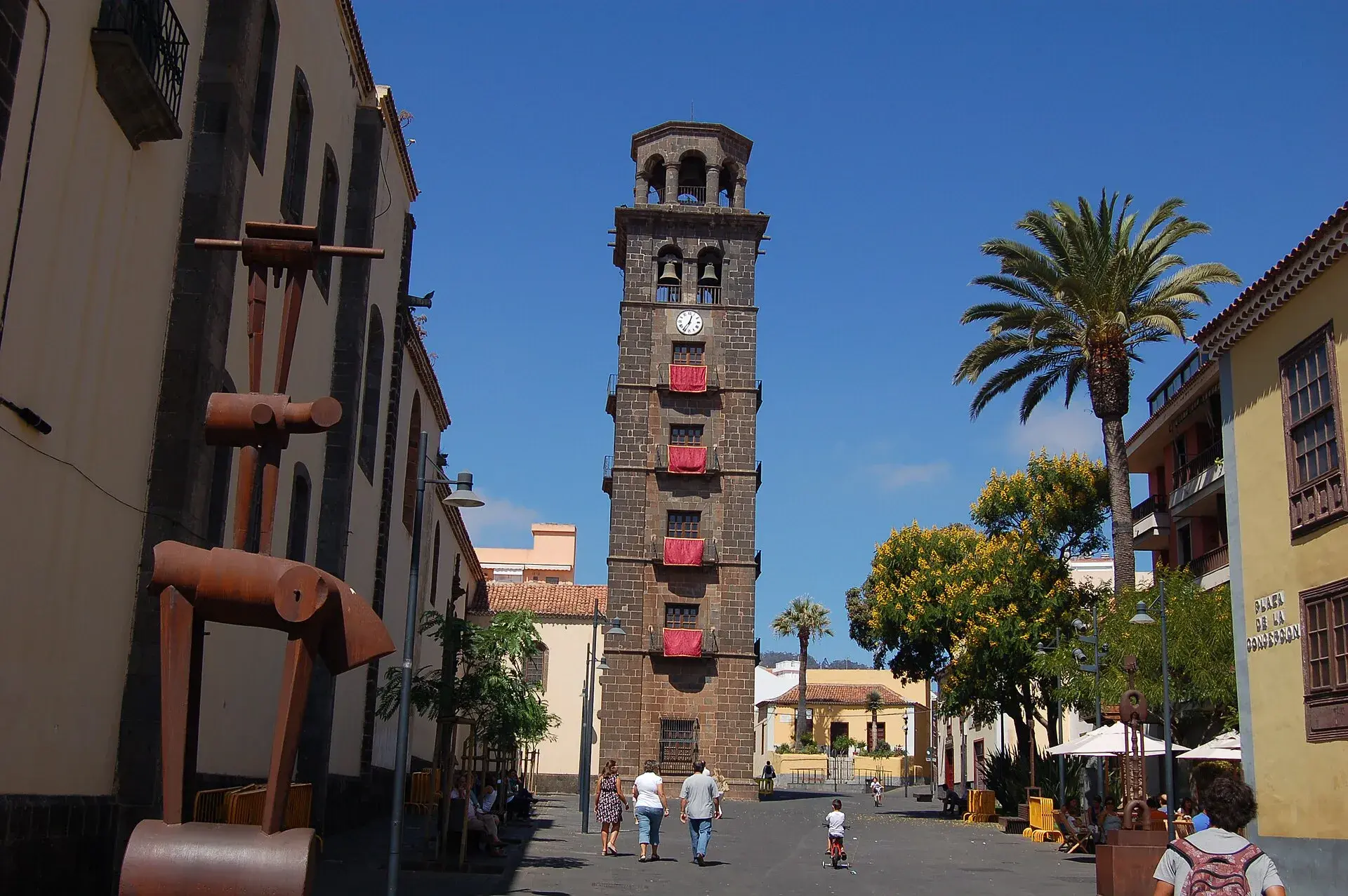
La Laguna, Tenerife: old town, museums and how to get there
What to see in La Laguna step by step: walking route through the World Heritage old town, cathedral, museums, tram, parking, festivals and a trip to Anaga.
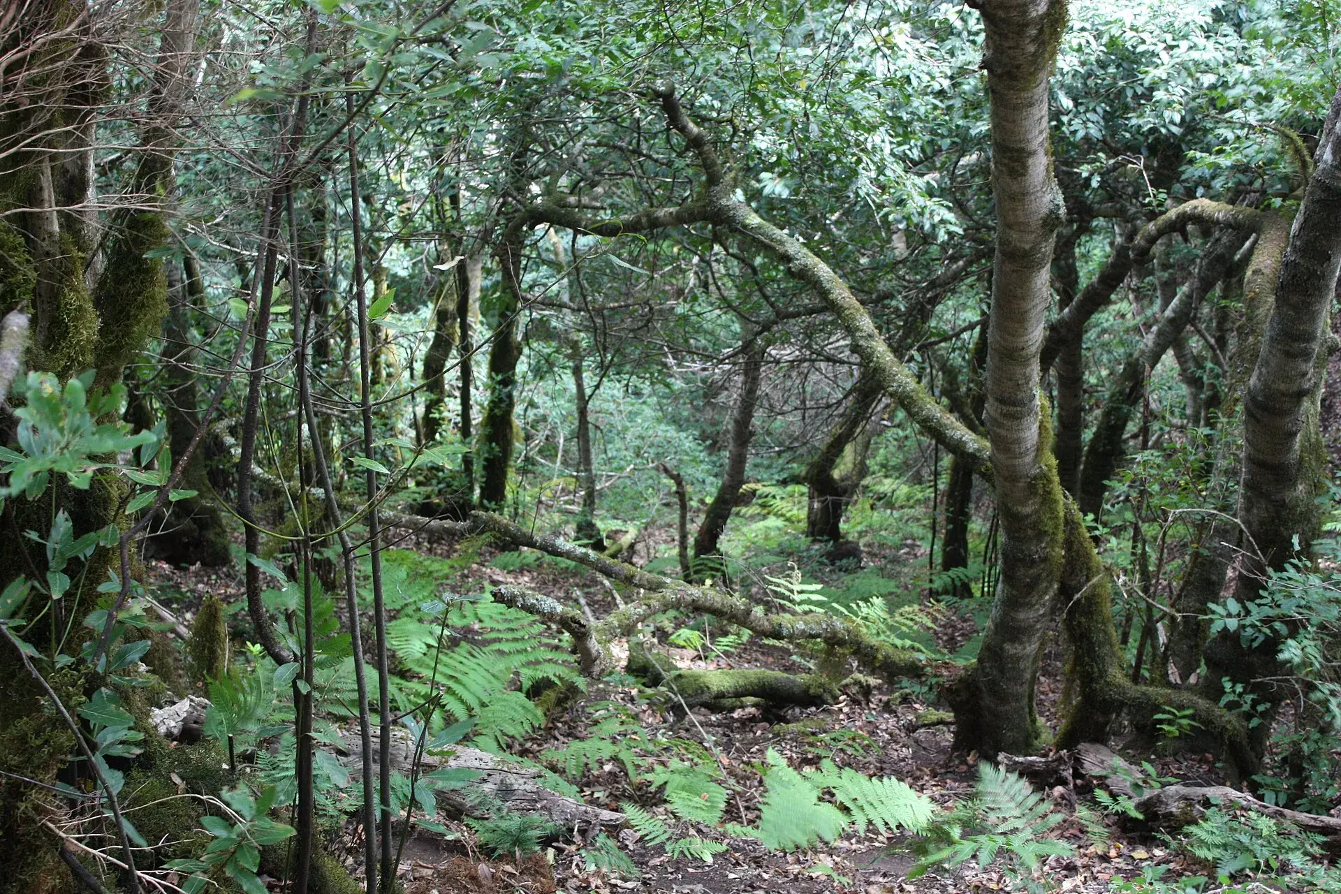
Tenerife protected areas rules: trail quotas and drones
Rules for Tenerife's protected areas: trails that need booking, Teide, Masca and El Pijaral, drones, camping, wildfire alerts, dogs and fines in 2026.
Puerto de la Cruz: Lago Martiánez, old town and gardens
What to see in Puerto de la Cruz: Lago Martiánez, Playa Jardín, Plaza del Charco, La Ranilla, the Botanical Garden, Sitio Litre and Loro Parque, buses, parking.