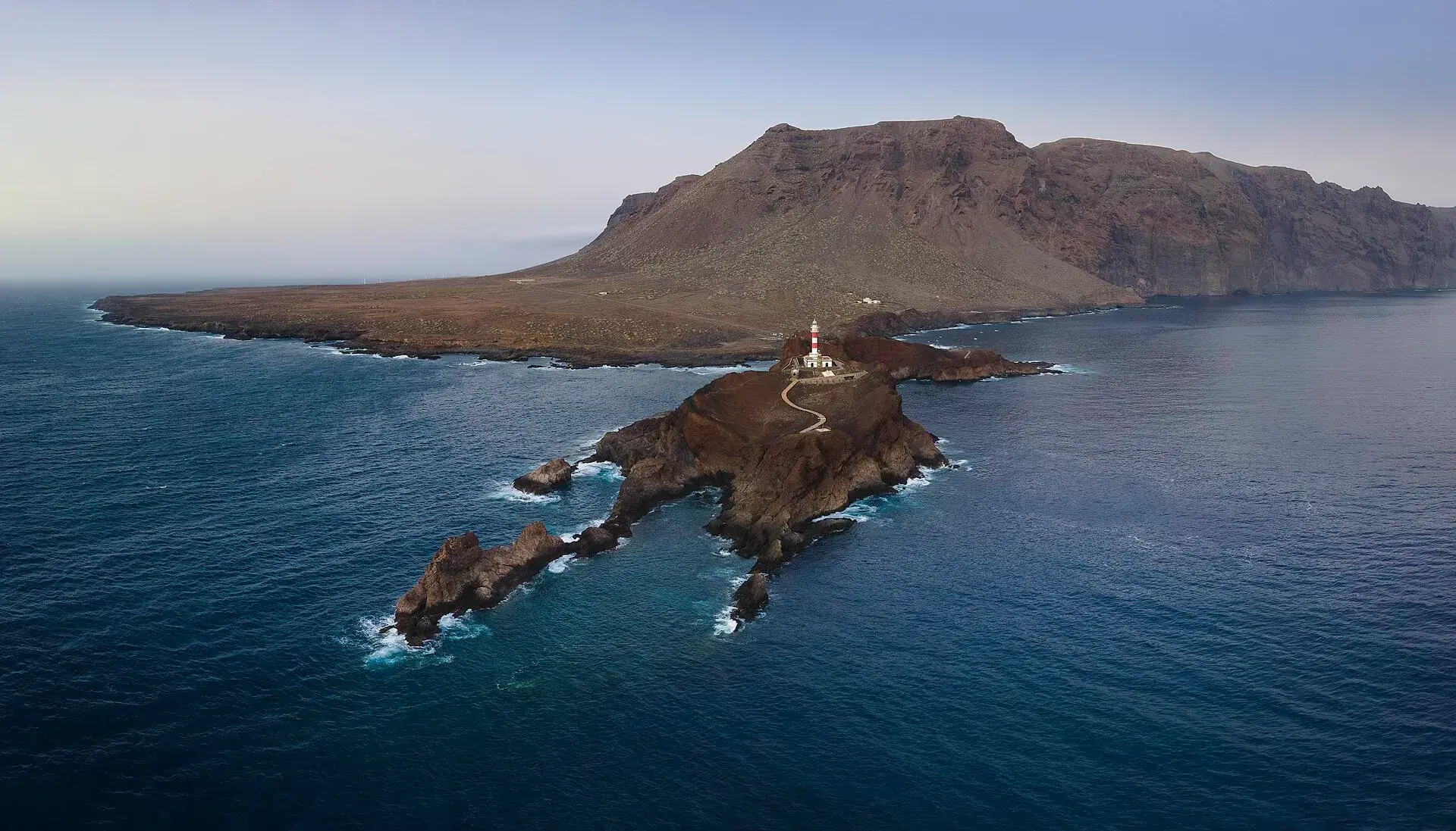
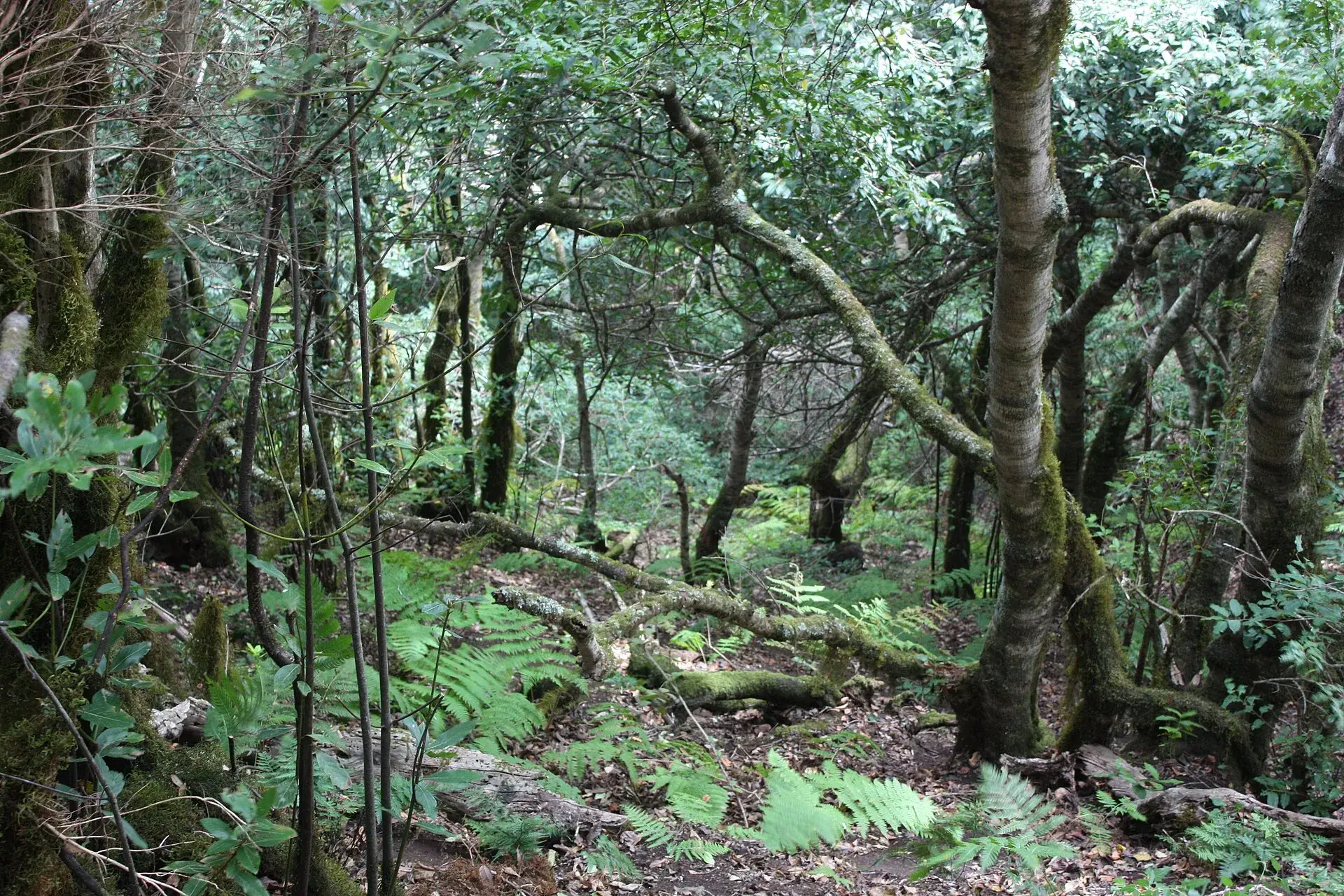
Photo by Werner Wilmes, CC BY 2.0, via Wikimedia Commons
Teno Rural Park and Punta de Teno: access, trails and viewpoints
Teno Rural Park is the protected area covering the north-western tip of Tenerife: an ancient massif of some 8,000 hectares, shared between Buenavista del Norte, Los Silos, El Tanque and Santiago del Teide, with cliffs, ravines, stone hamlets and more than 100 kilometres of official trails. Its most visited spot, Punta de Teno, comes with a condition in 2026 that you should know before setting off: since 19 January 2026, because of works on the TF-445, access by private car, on foot and by bicycle is banned every day, and you can only get there on bus (guagua) 369 from Buenavista del Norte, by taxi or with authorisation. The rest of the park (Masca, El Palmar, Teno Alto, Los Carrizales, the viewpoints on the TF-436) can be explored by car and on foot as normal, except for the checkpoints on the TF-436 on wildfire alert days.
What Teno Rural Park is
Teno is the oldest part of Tenerife. It was an independent island that became joined to the rest when later eruptions filled the space between it and the Anaga and Adeje massifs. That age shows in the landscape: deep ravines carved by erosion, sharp ridges and walls dropping into the sea, such as the Los Gigantes cliffs on its southern face.
The Canary Islands Natural Areas Act of 1994 classified it as a Rural Park, the designation that protects landscapes where traditional farming continues. That is why Teno is not an empty park: in its hamlets people still herd goats, farm terraces and make cheese. The Tenerife tourist board puts its area at 8,063 hectares.
Ecosystems change within a few kilometres: laurisilva (humid laurel forest) in the Monte del Agua, above Erjos and Los Silos; heath and scrub on the summits; cardón spurge and tabaiba scrub on the dry southern and western slopes. Notable wildlife includes the Teno giant lizard, the osprey on the cliffs and the endemic laurel-forest pigeons, Bolle's pigeon and the laurel pigeon. At sea, the Teno-Rasca strip is home to resident pilot whales and dolphins.
Punta de Teno and its lighthouse: getting there in 2026
Punta de Teno is the westernmost cape of Tenerife: a tongue of lava with two lighthouses (the old stone one from 1897 and the current one from 1978), a small cove, and a view of the Los Gigantes cliffs in profile, with La Gomera to the west. The road that leads there, the TF-445, starts in Buenavista del Norte and is cut into the cliff, with tunnels and a risk of rockfall.
Current access rules
According to Buenavista del Norte Town Council, from Monday 19 January 2026 until the works are finished:
- Banned every day: access by private vehicle, on foot and by bicycle.
- Allowed: bus 369, taxis and authorised vehicles, with possible waits depending on how the works progress.
- Full closures: the TF-445 is closed for weather alerts or other safety reasons; the bus does not run then either.
- End date: none published.
Before the current works, access was already regulated: from April 2025, during the restoration of the lighthouse, the Cabildo (the island government) and the Town Council restricted private cars, and in previous years the road was closed to private traffic at weekends and on public holidays. The only constant is that the rules change: check the Town Council website the day before.
Bus 369
- Route: Buenavista del Norte bus station–Punta de Teno, with intermediate stops (San Sebastián, Cruz de Toledo, Barranco Itobal).
- Duration: about 20 minutes.
- Price: €1 per person per journey, in cash or by card; TITSA tourist passes are valid.
- Timetable as of October 2026: departures from Buenavista from 8:20 on weekdays (8:00 at weekends and on public holidays), roughly every hour, with the last return from Punta de Teno at 19:50. Confirm on the TITSA website.
- Parking: next to Buenavista bus station and at the Cruz de Toledo stop.
To reach Buenavista by bus, line 363 comes from Puerto de la Cruz via Icod, Garachico and Los Silos. For Punta de Teno, allow an hour and a half in total: the return trip on the 369 from Buenavista plus your time at the lighthouse.
At the lighthouse
There are no facilities: no bar and no toilets. Bring water, sun protection and something warm, because it is often windy. Swimming in the cove only makes sense when the sea is calm; it is open sea, with currents and no lifeguards. Sunset is the best time, but check that the last return bus lets you see it.
The hamlets of Teno
Masca, access from the south
The best-known hamlet clings above its ravine on the TF-436, the road between Santiago del Teide and Buenavista. You can visit it freely: church, stone houses and a viewpoint over the ravine with few parking spaces. Hiking down the ravine to the sea is another matter (booking, bus 355, descent with exit by boat), explained in the Masca gorge. Since 30 July 2026 the Cabildo has been running checkpoints on the TF-436, between 9:00 and 16:00, on wildfire alert days: during those hours visitors' vehicles cannot pass and the alternative is bus 355.
El Palmar and Las Portelas
On the northern side, a few minutes from Buenavista, El Palmar is recognisable by its terraced volcano. Here you will find the Los Pedregales Visitor Centre (finca Los Pedregales, El Palmar), the park's information point and the start of the Callejón de Teno trail; check its opening hours before you go. Las Portelas, a little higher up, is the starting point for routes towards Masca and the Monte del Agua.
Teno Alto
From El Palmar a narrow road climbs to the Teno Alto plateau, a hamlet of whitewashed stone houses, terraces and pastures where goat farming and cheesemaking continue. The Los Bailaderos neighbourhood has a small square where several trails end. There is no practical bus: go up by car or on foot. Parking is scarce and fills up at weekends.
Los Carrizales
A small hamlet on the southern side, above the ravine of the same name, reached from the TF-436 between Masca and El Palmar. Its ravine is used for canyoning, with a company or with a prior booking on Tenerife ON, as it lies in a moderate-use zone; more on this activity in the best outdoor activities in Tenerife.
Teno viewpoints
- Cherfe: at the high point of the TF-436 between Santiago del Teide and Masca. You see the entire Masca ravine, with the hamlet below and La Gomera and La Palma on the horizon. Small roadside car park. Best in the morning.
- Altos de Baracán: at the top of the TF-436, around kilometre 12, between Las Portelas and Masca. It looks over the Los Carrizales ravine and the El Palmar valley; it has a car park and trails start here. It is usually windy.
- Cruz de Hilda: also on the TF-436, above Masca, with a café, car park and bus stop.
- Punta de Teno: sunset over the sea, with the access conditions explained above.
To combine them with other viewpoints on the island, see the best viewpoints in Tenerife.
Top trails
Data from the official route sheets of the Tenerife tourist board and the Cabildo (Tenerife ON). Distances for some routes vary between sources; treat them as a guide.
- PR-TF 57 Callejón de Teno (El Palmar–Los Bailaderos): 4.1 km one way, about 2 hours, moderate difficulty, with a climb of about 440 metres along a cobbled path. It starts at the Los Pedregales Visitor Centre and reaches the Los Bailaderos square, in Teno Alto. Ideal for: a first taste of the park.
- PR-TF 59 Las Portelas–Masca: around 3.7 km, easy according to the Tenerife tourist board, with views of the massif and the Masca ravine. One way: plan your return.
- PR-TF 52 Erjos–Las Portelas (Monte del Agua): about 10.7 km through the laurel forest, moderate to hard depending on the source. Ideal for: anyone looking for humid forest and shade.
- PR-TF 53 Los Silos–Cuevas Negras–Erjos: climbs a ravine to an abandoned hamlet. It is the trail of the Isla Baja; the guide to what to see in Garachico places it next to Los Silos.
- PR-TF 51 San José de los Llanos–Punta de Teno: the traverse that crosses the park from east to west via Teno Alto and Baracán, hard. While the TF-445 remains closed to pedestrians, its final section towards the lighthouse cannot be walked: check its status before planning it.
As of October 2026, a temporary Cabildo measure allows the park's published trails to be walked without authorisation or booking until 31 December 2026. The Masca gorge and canyoning have their own regulations. More routes by difficulty in the best hikes in Tenerife.
Buenavista del Norte, the base
Buenavista del Norte is the village at the north-western tip and the northern gateway to Teno: a square, the church of Los Remedios, a coast of callaos (rounded pebbles) and the bus station from which the 369 departs. The El Palmar farmers' market opens at the Los Pedregales estate, at the start of the road to Teno Alto; check days and hours with the Town Council. For food, there are casas de comidas (simple eateries) serving Canarian cooking in the village, in El Palmar and in Teno Alto.
Rules and safety
- Stay on the waymarked trails. Do not cut corners or build stone stacks.
- Leave nothing behind: no rubbish, no cigarette butts. Do not pick plants or take stones.
- Fire is banned outside designated areas; in summer the wildfire risk is high and closures may be activated.
- Drones: the park is a protected area; check the regulations before flying.
- Animals: do not disturb or feed them; if you find an injured one, call 112.
- Roads: the TF-436 and the road up to Teno Alto are narrow, with hairpin bends and single-lane sections. Give way at passing places and do not trust your satnav's times.
- Changeable weather: the north face easily fills with fog and it can rain while the south is clear. Bring a waterproof and water.
- Emergencies: 112.
Best time to go
October to May is the best season for walking in Teno, with mild temperatures and green hillsides after the rains. In summer, set off early: the southern slopes build up heat and there is little shade outside the laurel forest. In winter there is more fog, more mud and more closures of the TF-445 due to bad weather.
Frequently asked questions
Can you drive to Punta de Teno in 2026?
No. Since 19 January 2026, because of the works on the TF-445, access by private car, on foot and by bicycle is banned every day. You go up on bus 369 from Buenavista del Norte bus station (about 20 minutes, €1) or by taxi.
How much time do you need for Teno Rural Park?
A full day gives you Punta de Teno in the morning, a short trail such as the Callejón de Teno and the TF-436 viewpoints towards Masca in the afternoon. With half a day, choose between the lighthouse and Masca.
Do you need a permit to walk in Teno?
As of October 2026, not for the published trails: a temporary Cabildo measure allows access without authorisation until 31 December 2026. The Masca gorge requires a booking, and so does the descent of the Los Carrizales ravine.
What is the easiest trail in Teno?
According to the Tenerife tourist board, the PR-TF 59 between Las Portelas and Masca is easy, with views of the Masca ravine. The Callejón de Teno is somewhat more demanding because of the cobbled climb, but short.
Can you combine Teno with Garachico and Los Gigantes?
Yes. Garachico is about 15 minutes from Buenavista along the coast, and Los Gigantes, on the other side of the massif, is reached via Santiago del Teide. The sensible plan is Garachico and Punta de Teno one day, and Masca and Los Gigantes another.
Keep planning
You may also like
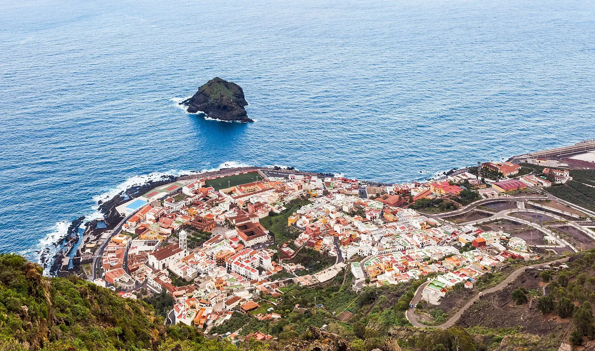
Garachico, Tenerife: old town, El Caletón and the Isla Baja
What to see in Garachico in half a day: the port buried by lava in 1706, the historic centre, El Caletón, the castle, San Roque, buses and where to park.
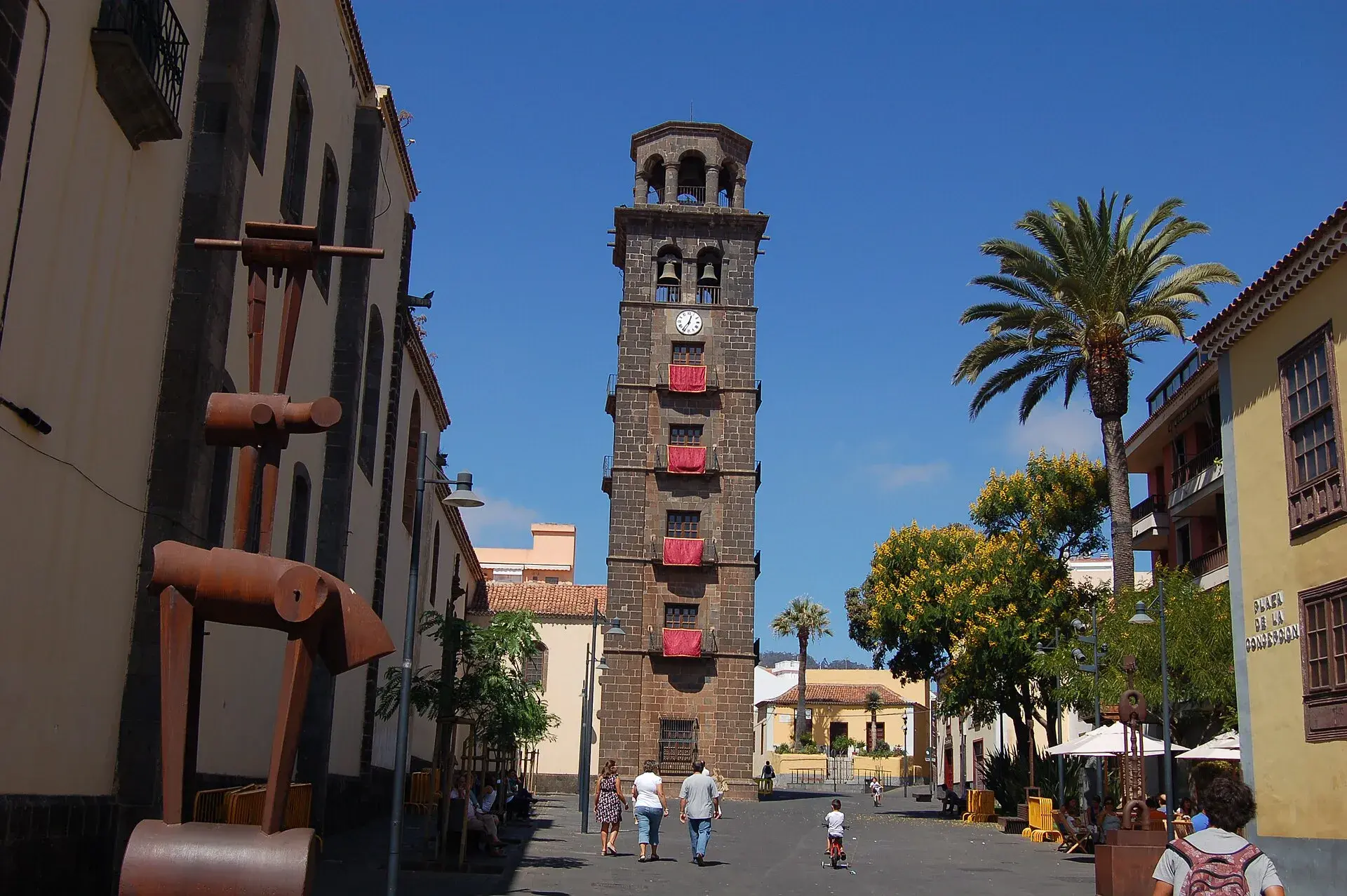
La Laguna, Tenerife: old town, museums and how to get there
What to see in La Laguna step by step: walking route through the World Heritage old town, cathedral, museums, tram, parking, festivals and a trip to Anaga.
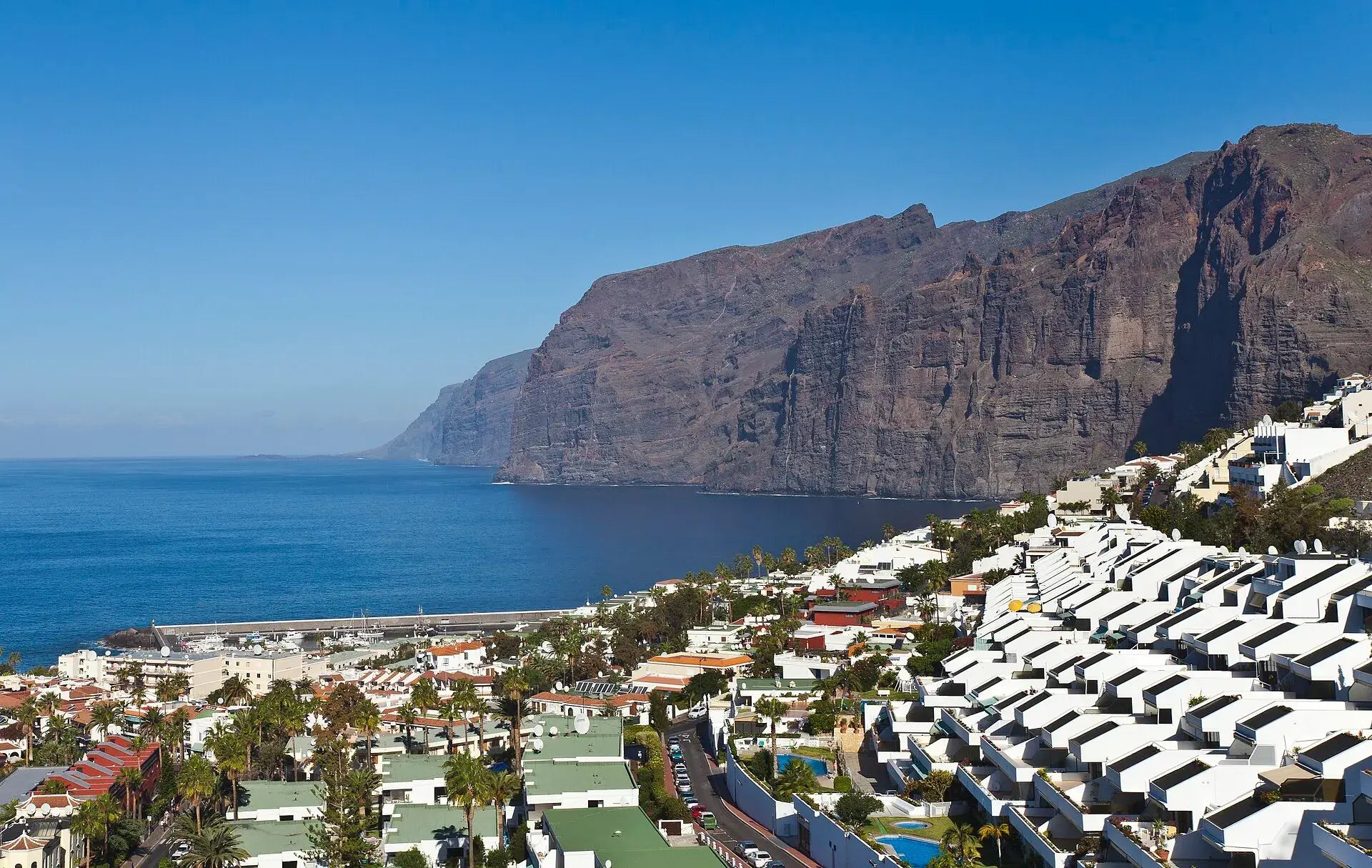
Los Gigantes Tenerife: cliffs, boat trips, beaches and access
Los Gigantes (Tenerife): cliffs up to 600 m, Archipenque viewpoint, boats from the marina, Los Guíos, rock pools, buses 473 and 477 and where to park.
Tenerife protected areas rules: trail quotas and drones
Rules for Tenerife's protected areas: trails that need booking, Teide, Masca and El Pijaral, drones, camping, wildfire alerts, dogs and fines in 2026.